
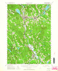
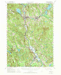
1956 Map of Penacook
USGS Topo · Published 1959About this map
Daniel Webster Birthplace and the Daniel Webster Home for Children anchor the historical landscape of this region, which was surveyed at the mid-century as the Merrimack River valley industrial and residential hubs continued to expand. The convergence of the Winnipesaukee River and Pemigewasset River at Franklin highlights a classic New England river-town geography, where the Boston and Maine RR corridors once provided critical transportation links. Infrastructure of the era is prominent, including the Franklin Falls Dam and the Blackwater Dam, which significantly altered the local drainage patterns. Educational and civic life is reflected in sites like the Kezer Seminary and the Soldiers Home, alongside numerous rural schoolhouses such as the Carter Sch and Plains Sch. Further south, the map details the winding course of the Merrimack through Boscawen and Penacook, revealing a dense network of country roads and family-named landmarks like Gerrish Corner and Snyders Mill that offer significant value for genealogical research.
Find a feature on this map
125 named features on this map. Tap any name to fly to it.
Don’t see what you’re looking for? This feature index may not catch every label — zoom into the map to look around manually.
Map Details
Editions of this 1956 Penacook Map
3 editions found
Other maps of this area

1909 · Winnepesaukee
USGS Topo · 1:62,500

1919 · Gilmanton
USGS Topo · 1:62,500

1921 · Suncook
USGS Topo · 1:62,500

1925 · Holderness
USGS Topo · 1:62,500

1926 · Hillsboro
USGS Topo · 1:62,500

1927 · Concord
USGS Topo · 1:62,500

1927 · Penacook
USGS Topo · 1:62,500

1927 · Gilmanton
USGS Topo · 1:62,500

1927 · Holderness
USGS Topo · 1:62,500

1927 · Cardigan
USGS Topo · 1:62,500