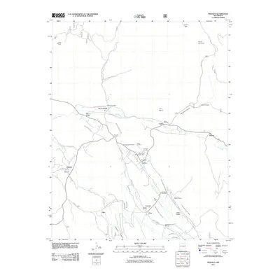
2011 Map of Penasco
USGS Topo · Published 2011About this map
Picuris Pueblo and the surrounding villages of the High Road to Taos region are documented in this 2011 survey, showing a landscape defined by traditional water management. The intricate network of irrigation ditches, such as the Acequia Madre de Santa Barbara and Acequia Madre de Llano San Juan, illustrates the centuries-old agricultural systems still vital to communities like Peñasco and Rodarte. These acequias follow the contours of the Rio Pueblo and Rio Santa Barbara valleys, sustaining small settlements below the northern Picuris Mountains. For those researching family history, the map identifies numerous small burial grounds including the Rio Lucio Cemetery, Ramon Sanchez Cemetery, and Morada Cemetery. This study also captures modern infrastructure along State Road 73 and various Indian Service Routes, while preserving the location of local landmarks like the Vadito Post Office and the Camino Real District Ranger Office.
Find a feature on this map
63 named features on this map. Tap any name to fly to it.
Don’t see what you’re looking for? This feature index may not catch every label — zoom into the map to look around manually.
Map Details
Editions of this 2011 Penasco Map
This is the sole edition of this map. No revisions or reprints were ever made.
Other maps of this area

1953 · Truchas
USGS Topo · 1:24,000

1953 · Trampas
USGS Topo · 1:24,000

1954 · Raton
USGS Topo · 1:250,000

1958 · Raton
USGS Topo · 1:250,000

1961 · Carson
USGS Topo · 1:24,000

1964 · Tres Ritos
USGS Topo · 1:24,000

1964 · Ranchos De Taos
USGS Topo · 1:24,000

1964 · Penasco
USGS Topo · 1:24,000

1964 · Taos SW
USGS Topo · 1:24,000
1964 · Jicarita Peak
USGS Topo · 1:24,000