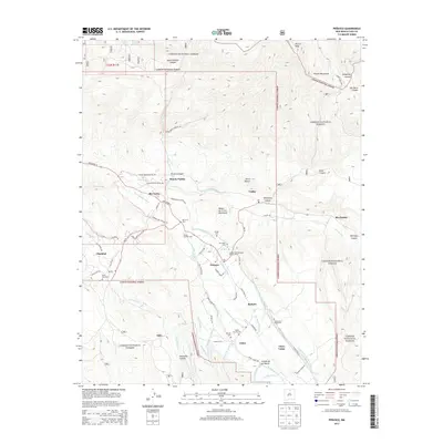
2013 Map of Penasco
USGS Topo · Published 2013About this map
Picuris Pueblo and the surrounding mountain valley settlements are detailed in this 2013 geographic study. The landscape is defined by an intricate network of irrigation ditches and creeks, including the Acequia Madre de Santa Barbara, Acequia del Sur, and Chamizal Cr, which support the high-altitude communities of Peñasco, Rio Lucio, and Vadito. The cultural imprint of the region is visible through numerous family and community burial grounds, such as Ramon Sanchez Cem and the Virgilio Trujillo Cem, located near the village of Llano.
Find a feature on this map
63 named features on this map. Tap any name to fly to it.
Don’t see what you’re looking for? This feature index may not catch every label — zoom into the map to look around manually.
Map Details
Editions of this 2013 Penasco Map
This is the sole edition of this map. No revisions or reprints were ever made.
Other maps of this area

1953 · Truchas
USGS Topo · 1:24,000

1953 · Trampas
USGS Topo · 1:24,000

1954 · Raton
USGS Topo · 1:250,000

1958 · Raton
USGS Topo · 1:250,000

1961 · Carson
USGS Topo · 1:24,000

1964 · Tres Ritos
USGS Topo · 1:24,000

1964 · Ranchos De Taos
USGS Topo · 1:24,000

1964 · Penasco
USGS Topo · 1:24,000

1964 · Taos SW
USGS Topo · 1:24,000
1964 · Jicarita Peak
USGS Topo · 1:24,000