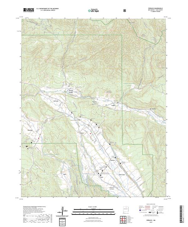
2023 Map of Penasco
USGS Topo · Published 2023About this map
Picuris Pueblo and a series of historic mountain settlements define this high-altitude landscape within the Carson National Forest. The geography is shaped by the complex network of irrigation ditches and water rights, including the Acequia Madre, Acequia del Sur, and Chamisal Ditch, which sustain the communities of Rio Lucio, Peñasco, and Llano. These valleys at the edge of the Sangre de Cristo Mountains are notable for their density of community landmarks, particularly spiritual sites such as the Saint Anthony Catholic Cem and the Capilla de Llano de San Juan y Campo Santo Cem. Traditional land use patterns are evident in the alignment of roads like the El Camino Publico de Picuris and numerous Indian Service Routes that connect the pueblo to the surrounding canyons and peaks.
Find a feature on this map
81 named features on this map. Tap any name to fly to it.
Don’t see what you’re looking for? This feature index may not catch every label — zoom into the map to look around manually.
Map Details
Editions of this 2023 Penasco Map
This is the sole edition of this map. No revisions or reprints were ever made.
Other maps of this area

1953 · Truchas
USGS Topo · 1:24,000

1953 · Trampas
USGS Topo · 1:24,000

1954 · Raton
USGS Topo · 1:250,000

1958 · Raton
USGS Topo · 1:250,000

1961 · Carson
USGS Topo · 1:24,000

1964 · Tres Ritos
USGS Topo · 1:24,000

1964 · Ranchos De Taos
USGS Topo · 1:24,000

1964 · Penasco
USGS Topo · 1:24,000

1964 · Taos SW
USGS Topo · 1:24,000
1964 · Jicarita Peak
USGS Topo · 1:24,000