
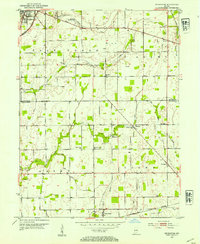
1953 Map of Pendleton
USGS Topo · Published 1954About this map
Pendleton serves as the primary hub in the northwest corner of this Madison and Hancock County landscape, where the New York Central railroad tracks cut a diagonal path toward the town center. The mid-century agrarian character of the region is defined by a dense network of country roads connecting small settlements like Warrington, Milners Corner, and Willow Branch. Local heritage is preserved in the numerous rural congregations and burial grounds scattered throughout the townships, including the historic Meeting House near Fall Creek and the Zion Chapel to the east.
Find a feature on this map
34 named features on this map. Tap any name to fly to it.
Don’t see what you’re looking for? This feature index may not catch every label — zoom into the map to look around manually.
Map Details
Editions of this 1953 Pendleton Map
2 editions found
Other maps of this area

1952 · Greenfield
USGS Topo · 1:24,000

1952 · Ingalls
USGS Topo · 1:24,000

1952 · Anderson
USGS Topo · 1:24,000

1953 · Lapel
USGS Topo · 1:24,000

1953 · Cincinnati
USGS Topo · 1:250,000

1953 · Muncie
USGS Topo · 1:250,000

1956 · Muncie
USGS Topo · 1:250,000

1956 · Cleveland
USGS Topo · 1:24,000

1957 · Cincinnati
USGS Topo · 1:250,000

1960 · Middletown
USGS Topo · 1:24,000