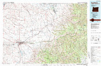
1983 Map of Pendleton
USGS Topo · Published 1984About this map
The Umatilla River valley serves as the central artery for this 1983 landscape, where the Union Pacific railroad and Interstate 84 trace a path through the transition from high plateau wheat country to the timbered slopes of the Umatilla National Forest. The regional hub of Pendleton is documented with its major civic anchors, including Blue Mtn Community College, the State Hospital, and the Pendair Heights area near the Pendleton Municipal Airport.
Find a feature on this map
108 named features on this map. Tap any name to fly to it.
Don’t see what you’re looking for? This feature index may not catch every label — zoom into the map to look around manually.
Map Details
Editions of this 1983 Pendleton Map
This is the sole edition of this map. No revisions or reprints were ever made.
Other maps of this area

1906 · Telocaset
USGS Topo · 1:125,000

1908 · Umatilla
USGS Topo · 1:125,000

1915 · Wallulah
USGS Topo · 1:96,000

1917 · Pasco
USGS Topo · 1:125,000

1918 · Wallula
USGS Topo · 1:125,000

1919 · Walla Walla
USGS Topo · 1:125,000

1921 · Walla Walla
USGS Topo · 1:125,000

1935 · Pendleton
USGS Topo · 1:125,000

1937 · Pomeroy
USGS Topo · 1:96,000

1942 · Pomeroy
USGS Topo · 1:125,000