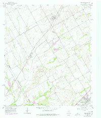
1956 Map of Penelope
USGS Topo · Published 1978About this map
Penelope sits at the northern end of this central Texas landscape, where the agricultural patterns of Hill Co and Mc Lennan Co meet. The area is defined by a dense network of seasonal watercourses, including Tehuacana Creek and Little Cottonwood Creek, which carve through the farmland. Local genealogy is well-preserved here through numerous family and ethnic burial sites, such as the Czech National Cem and George Newton Cem, reflecting the heritage of the early settlers.
Find a feature on this map
22 named features on this map. Tap any name to fly to it.
Don’t see what you’re looking for? This feature index may not catch every label — zoom into the map to look around manually.
Map Details
Editions of this 1956 Penelope Map
2 editions found
Other maps of this area

1892 · Waco
USGS Topo · 1:125,000

1920 · Waco
USGS Topo · 1:125,000

1920 · Mart
USGS Topo · 1:62,500

1931 · Elm Mott
USGS Topo · 1:62,500

1954 · Waco
USGS Topo · 1:250,000

1955 · Waco
USGS Topo · 1:250,000

1956 · Hubbard
USGS Topo · 1:24,000

1956 · Penelope
USGS Topo · 1:24,000

1956 · Axtell
USGS Topo · 1:24,000

1956 · Abbott
USGS Topo · 1:24,000