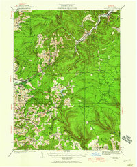
1929 Map of Penfield
USGS Topo · Published 1959About this map
Boone Mountain dominates the northern landscape of this region, a rugged divide separating the waters of Sandy Lick Creek from the Bennett Branch Pennsylvania Canal. The 1920s topography reveals a remote interior of Clearfield Co and Elk Co defined by forestry and high-altitude infrastructure, including the Boone Mountain Fire Tower and the Smith Fire Tower. The settlement pattern follows the narrow valleys, with Penfield and Winterburn serving as hubs along the Pennsylvania RR and the Buffalo Rochester And Pittsburgh railroad line.
Find a feature on this map
115 named features on this map. Tap any name to fly to it.
Don’t see what you’re looking for? This feature index may not catch every label — zoom into the map to look around manually.
Map Details
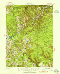
Editions of this 1929 Penfield Map
3 editions found
Other maps of this area

1903 · Curwensville
USGS Topo · 1:62,500

1903 · Houtzdale
USGS Topo · 1:62,500

1905 · Houtzdale
USGS Topo · 1:62,500

1906 · Punxsutawney
USGS Topo · 1:62,500

1922 · Du Bois
USGS Topo · 1:62,500

1924 · Du Bois
USGS Topo · 1:62,500

1929 · Clearfield
USGS Topo · 1:48,000

1929 · Penfield
USGS Topo · 1:62,500

1932 · Clearfield
USGS Topo · 1:62,500

1932 · Penfield
USGS Topo · 1:62,500