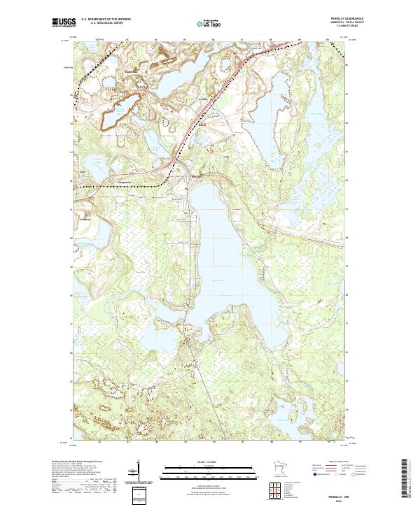
2022 Map of Pengilly
USGS Topo · Published 2022About this map
Swan Lake dominates the central landscape of this Itasca County region, where the iron-rich geology of the Mesabi Range has significantly shaped the topography and settlement patterns. The map highlights the industrial legacy of the area through features like the Patrick Stilling Basin and various water bodies like Ox Hide Lake and Snowball Lake. Communities such as Nashwauk, Pengilly, and Calumet are situated along the transit corridors that once served the mining industry, now reflected in the Alborn-Pengilly Railroad Trail MS84.029 Trl. The complex hydrography of the northern lakes region is evident in the sprawling networks of O'Brien Creek and Oxhide Creek, which weave between small residential clusters like Cooley and Jurgenson. This survey provides a clear view of the modern infrastructure and natural water systems that define the Iron Range's unique geography.
Find a feature on this map
59 named features on this map. Tap any name to fly to it.
Don’t see what you’re looking for? This feature index may not catch every label — zoom into the map to look around manually.
Map Details
Editions of this 2022 Pengilly Map
This is the sole edition of this map. No revisions or reprints were ever made.
Other maps of this area

1920 · Trout Lake
USGS Topo · 1:62,500

1952 · Keewatin
USGS Topo · 1:24,000

1952 · Nashwauk
USGS Topo · 1:24,000

1952 · Silica
USGS Topo · 1:24,000

1952 · Calumet
USGS Topo · 1:24,000

1952 · Pengilly
USGS Topo · 1:24,000

1954 · Hibbing
USGS Topo · 1:250,000

1957 · Hibbing
USGS Topo · 1:250,000

1958 · Hibbing
USGS Topo · 1:250,000

1964 · Hibbing
USGS Topo · 1:250,000