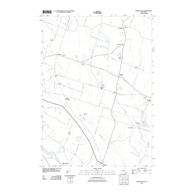
2010 Map of Pennellville
USGS Topo · Published 2010About this map
Great Bear Springs and the Oswego River corridor define the southwestern reaches of this Oswego County landscape, where the Oswego Canal traces the river's edge near Hinmansville. The interior is characterized by a network of small agricultural settlements and family-named landmarks like Farley Corners, Loomis Corner, and Suttons Corner. Numerous burial grounds, including the Sixteenth Cemetery and Gilberts Mills Cemetery, are scattered across the terrain, serving as vital points of reference for genealogists. To the southeast, the village of Pennellville sits near the confluence of local drainage, while the presence of the Great Bear Siding reflects the historic importance of rail transport in moving goods from this rural district. Wooded rises such as Bristol Hill and Woodchuck Hill provide relief from the surrounding wetlands of Beaver Meadow.
Find a feature on this map
79 named features on this map. Tap any name to fly to it.
Don’t see what you’re looking for? This feature index may not catch every label — zoom into the map to look around manually.
Map Details
Editions of this 2010 Pennellville Map
This is the sole edition of this map. No revisions or reprints were ever made.
Other maps of this area

1895 · Syracuse
USGS Topo · 1:62,500

1898 · Syracuse
USGS Topo · 1:62,500

1900 · Baldwinsville
USGS Topo · 1:62,500

1900 · Fulton
USGS Topo · 1:62,500

1905 · Mexico
USGS Topo · 1:62,500

1940 · Brewerton
USGS Topo · 1:24,000

1943 · Oswego East
USGS Topo · 1:31,680

1943 · Lysander
USGS Topo · 1:31,680

1943 · New Haven
USGS Topo · 1:31,680

1943 · Brewerton
USGS Topo · 1:31,680