
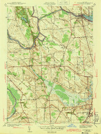
1943 Map of Brewerton
USGS Topo · Published 1943About this map
Oneida Lake feeds into the Oneida River at the historic crossing of Brewerton, where the Barge Canal system utilized the natural waterways to facilitate New York commerce. This mid-century survey reveals a transition from the riparian activity at Oak Orchard and Baldwin to the emerging suburban structure of North Syracuse and Elmcrest. Significant engineering is visible at Lock 23 and the Schroeppel Bridge, while the interior landscape is defined by the expansive Peat Swamp and several family-named landmarks like Rodger Corner. Local genealogy is well-supported by numerous rural schoolhouses, including Sand Ridge Sch, Mud Mill Sch, and Brown Sch, alongside the Pine Plains Cem. The path of the New York Central Oswego Branch highlights the rail-dependent economy of the era, connecting the disparate hamlets of Clay and Euclid through the fertile lowlands.
Find a feature on this map
74 named features on this map. Tap any name to fly to it.
Don’t see what you’re looking for? This feature index may not catch every label — zoom into the map to look around manually.
Map Details
Editions of this 1943 Brewerton Map
2 editions found
Other maps of this area

1895 · Syracuse
USGS Topo · 1:62,500

1898 · Syracuse
USGS Topo · 1:62,500

1900 · Baldwinsville
USGS Topo · 1:62,500

1900 · Fulton
USGS Topo · 1:62,500

1905 · Mexico
USGS Topo · 1:62,500

1938 · Syracuse East
USGS Topo · 1:24,000

1939 · Syracuse West
USGS Topo · 1:24,000

1940 · Brewerton
USGS Topo · 1:24,000

1940 · Cicero
USGS Topo · 1:24,000
1943 · Syracuse East
USGS Topo · 1:31,680