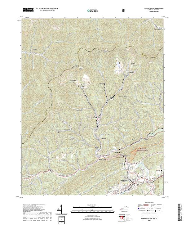
2022 Map of Pennington Gap
USGS Topo · Published 2022About this map
Pennington Gap serves as the focal point of this 2022 survey, positioned where the North Fork Powell River cuts through the formidable ridge of Stone Mountain. This landscape is defined by its deep hollows and narrow valleys, which have long shaped the settlement patterns of Lee County, Virginia, and Harlan County, Kentucky. Small mining and timber-related communities like St. Charles, Benedict, and Monarch are tucked into these drainages, connected by narrow roads such as Wagoner Town Rd and State Rd 616. The northern portion of the map is dominated by the Little Black Mtn Tennessee Valley Divide, a natural boundary between the two states. Extensive forested tracts of the Jefferson National Forest cover the eastern ridges, while family history is preserved in small burial grounds like Baker Cem, Napier Cem, and Pennington Cem. The presence of Turners Siding along the rail lines highlights the enduring industrial geography of the Appalachian coalfields.
Find a feature on this map
127 named features on this map. Tap any name to fly to it.
Don’t see what you’re looking for? This feature index may not catch every label — zoom into the map to look around manually.
Map Details
Editions of this 2022 Pennington Gap Map
This is the sole edition of this map. No revisions or reprints were ever made.
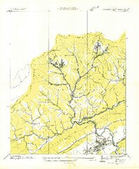
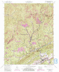
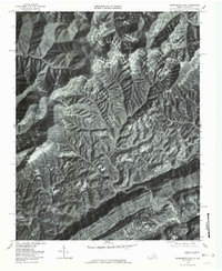
Historical Maps of Darbyville Through Time
4 maps found