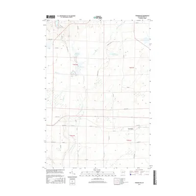
2015 Map of Pennington
USGS Topo · Published 2015About this map
The North Fork Jump River carves through the center of this Price County landscape, a region defined by extensive wetlands and wildlife management areas. The small settlement of Pennington is situated in the southeastern corner, serving as a focal point for the local road network that includes evocative names like Moonshine Aly and Blueberry Rd. The terrain is characterized by numerous managed water bodies, including the Canberry Cr Wildlife Flowage and Spring Cr Flowage, which highlight the area's history of water control for conservation and timber. Smaller tributaries like Thunder Cr and Needle Cr feed into the primary river system, while isolated lakes such as Lake Ten and Lake Sixteen dot the northern reaches of the township. This survey captures a moment in the modern management of Wisconsin's Northwoods, where the grid of the Public Land Survey System meets a landscape of flowing water and forest.
Find a feature on this map
40 named features on this map. Tap any name to fly to it.
Don’t see what you’re looking for? This feature index may not catch every label — zoom into the map to look around manually.
Map Details
Editions of this 2015 Pennington Map
This is the sole edition of this map. No revisions or reprints were ever made.
Other maps of this area

1941 · Kennan
USGS Topo · 1:48,000

1941 · Phillips
USGS Topo · 1:48,000

1943 · Philliips
USGS Topo · 1:48,000

1944 · Ogema
USGS Topo · 1:48,000

1945 · Kennan
USGS Topo · 1:48,000

1945 · Black River
USGS Topo · 1:48,000

1947 · Ogema
USGS Topo · 1:48,000

1949 · Ogema
USGS Topo · 1:48,000

1949 · Jump River Fire Tower
USGS Topo · 1:48,000

1953 · Rice Lake
USGS Topo · 1:250,000