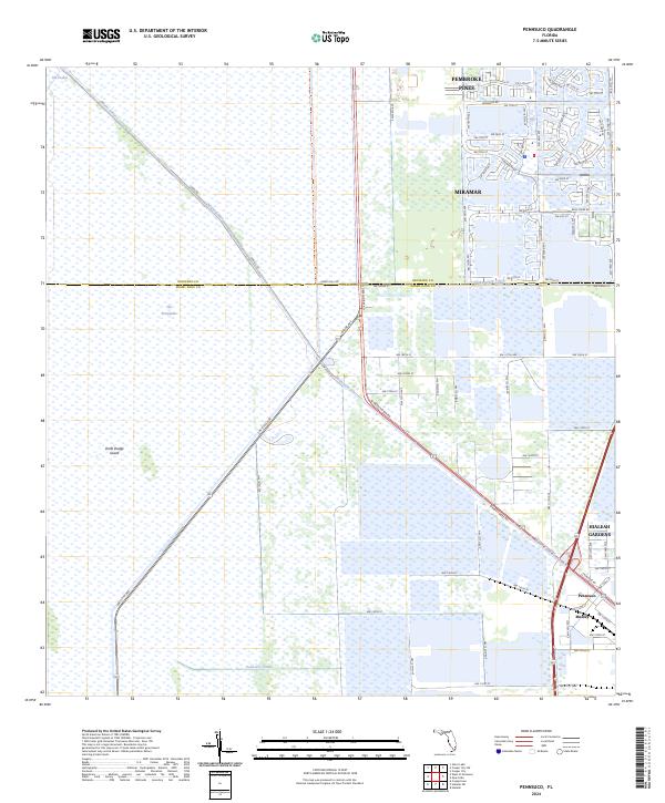
2024 Map of Pennsuco
USGS Topo · Published 2024About this map
The Everglades dominate the western portion of this landscape, showing the sharp boundary where suburban expansion meets protected conservation lands. Significant water control infrastructure defines the region, with the Miami Canal, Snake Creek Canal, and Pennsuco Canal cutting linear paths through the wetlands to manage drainage. Along the eastern edge, the transition to urban development is marked by the presence of Pembroke Pines, Miramar, and Hialeah Gardens. These settlements represent the westward reach of the metropolitan corridor, established alongside major transport routes like Okeechobee Rd and Krome Ave. Unique terrain features such as Draft Dodge Island and The Pocket are visible within the marshy expanses, while the small industrial and residential pockets of Pennsuco and Medley anchor the southeastern corner, reflecting the area's specialized land use at the edge of the swamp.
Find a feature on this map
85 named features on this map. Tap any name to fly to it.
Don’t see what you’re looking for? This feature index may not catch every label — zoom into the map to look around manually.
Map Details
Editions of this 2024 Pennsuco Map
This is the sole edition of this map. No revisions or reprints were ever made.
Other maps of this area

1949 · Opalocka
USGS Topo · 1:24,000

1950 · Hialeah
USGS Topo · 1:24,000

1956 · Miami
USGS Topo · 1:250,000

1956 · West Palm Beach
USGS Topo · 1:250,000

1957 · West Palm Beach
USGS Topo · 1:250,000

1958 · West Palm Beach
USGS Topo · 1:250,000

1958 · Miami
USGS Topo · 1:250,000
1962 · Hialeah
USGS Topo · 1:24,000

1962 · Opa-locka
USGS Topo · 1:24,000

1963 · Pennsuco
USGS Topo · 1:24,000