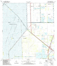
1988 Map of Pennsuco
USGS Topo · Published 1988About this map
The Everglades and Francis S Taylor Wildlife Management Area dominates the western half of this Florida landscape, defined by a massive system of engineered levees and roads. This late 1980s record illustrates the stark contrast between the impounded conservation waters and the rapidly encroaching urban developments of Pembroke Pines and Miramar to the east. Water management infrastructure is central here, with the Miami Canal No C-6 and Snake Creek Canal No C-9 carving through the terrain.
Find a feature on this map
32 named features on this map. Tap any name to fly to it.
Don’t see what you’re looking for? This feature index may not catch every label — zoom into the map to look around manually.
Map Details
Editions of this 1988 Pennsuco Map
2 editions found
Other maps of this area

1949 · Opalocka
USGS Topo · 1:24,000

1950 · Hialeah
USGS Topo · 1:24,000

1956 · Miami
USGS Topo · 1:250,000

1956 · West Palm Beach
USGS Topo · 1:250,000

1957 · West Palm Beach
USGS Topo · 1:250,000

1958 · West Palm Beach
USGS Topo · 1:250,000

1958 · Miami
USGS Topo · 1:250,000
1962 · Hialeah
USGS Topo · 1:24,000

1962 · Opa-locka
USGS Topo · 1:24,000

1963 · Pennsuco
USGS Topo · 1:24,000