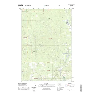
2020 Map of Penny Ridge
USGS Topo · Published 2020About this map
B Z Corner serves as a focal point for this 2020 landscape, situated near the eastern edge of the Gifford Pinchot National Forest. The area is defined by the steep drainages and prominent peaks of the Monte Cristo Range, where features like Nestor Peak and Penny Ridge dominate the elevation. To the southeast, the Spring Creek National Fish Hatchery sits near the base of Bald Mtn, reflecting the long-standing management of the region's aquatic resources. The White Salmon Wild and Scenic River carves through the eastern portion of the map, fed by a network of tributaries including Mill Cr and Buck Cr. This survey illustrates the intricate balance between protected forest lands and the rural road network, tracing routes like Gilmer Rd and Northwestern Lake Rd through complex topography.
Find a feature on this map
52 named features on this map. Tap any name to fly to it.
Don’t see what you’re looking for? This feature index may not catch every label — zoom into the map to look around manually.
Map Details
Editions of this 2020 Penny Ridge Map
This is the sole edition of this map. No revisions or reprints were ever made.
Other maps of this area

1926 · Hood River
USGS Topo · 1:125,000

1929 · Hood River
USGS Topo · 1:125,000

1934 · The Dalles
USGS Topo · 1:125,000

1953 · The Dalles
USGS Topo · 1:250,000

1956 · The Dalles
USGS Topo · 1:250,000

1957 · The Dalles
USGS Topo · 1:250,000

1957 · Willard
USGS Topo · 1:62,500

1957 · White Salmon
USGS Topo · 1:62,500

1957 · Husum
USGS Topo · 1:62,500

1957 · Hood River
USGS Topo · 1:62,500