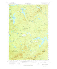
1956 Map of Penobscot Lake
USGS Topo · Published 1977About this map
The International Boundary between the United States and Canada defines the northwestern reaches of this Somerset County landscape, where the waters of Penobscot Lake dominate the highland terrain. This 1956 survey records a remote wilderness characterized by a complex network of glacial ponds and drainage basins, including Big Grenier Pond, Portage Lake, and Hale Pond. The hydrology of the region is anchored by the Penobscot River and its South Branch, which navigate through several townships like Prentiss and Hammond. Human presence is largely limited to the infrastructure of forest management and border monitoring, evidenced by the Fire Warden Camp and a Lookout Tower positioned on Boundary Bald Mtn. Numerous Jeep Trails and the Boundary Trail provide the primary means of access through the timberlands, connecting isolated peaks such as Green Mountain and Ironbound Mountain.
Find a feature on this map
78 named features on this map. Tap any name to fly to it.
Don’t see what you’re looking for? This feature index may not catch every label — zoom into the map to look around manually.
Map Details
Editions of this 1956 Penobscot Lake Map
4 editions found

Other maps of this area

1921 · Brassua Lake
USGS Topo · 1:62,500

1922 · Long Pond
USGS Topo · 1:62,500

1923 · Brassua Lake
USGS Topo · 1:62,500

1923 · Attean
USGS Topo · 1:62,500

1924 · Long Pond
USGS Topo · 1:62,500

1925 · Attean
USGS Topo · 1:62,500

1927 · Sandy Bay
USGS Topo · 1:48,000

1930 · Sandy Bay
USGS Topo · 1:62,500

1944 · Brassua Lake
USGS Topo · 1:62,500

1944 · Long Pond
USGS Topo · 1:62,500