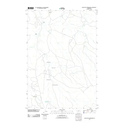
2011 Map of Pentecost Reservoir
USGS Topo · Published 2011About this map
Haystack Butte dominates the northern horizon of this landscape, where the seasonal drainage systems of Powder River County define the local geography. The map reveals a network of canyons and draws, such as Cedar Canyon, Kuster Canyon, and Quaking Aspen Draw, which channel runoff toward Crow Creek. This area's ranching and land-management history is reflected in the sparse infrastructure, primarily consisting of unpaved routes like Jim's Rd and Crow Creek Rd. At the southern end of the sheet, Pentecost Reservoir serves as a critical water source in an otherwise arid terrain characterized by features like Moody Draw and Reynolds Draw. The naming of local landmarks, including Hay Draw and Pentecost Draw, suggests a history tied to early homesteading and livestock grazing in the Montana plains.
Find a feature on this map
15 named features on this map. Tap any name to fly to it.
Don’t see what you’re looking for? This feature index may not catch every label — zoom into the map to look around manually.
Map Details
Editions of this 2011 Pentecost Reservoir Map
This is the sole edition of this map. No revisions or reprints were ever made.
Other maps of this area

1954 · Ekalaka
USGS Topo · 1:250,000

1956 · Ekalaka
USGS Topo · 1:250,000

1958 · Ekalaka
USGS Topo · 1:250,000

1965 · Ekalaka
USGS Topo · 1:250,000

1979 · W L Butte
USGS Topo · 1:24,000

1979 · McKenzie Creek
USGS Topo · 1:24,000
1979 · Pocochichee Butte
USGS Topo · 1:24,000

1980 · Broadus
USGS Topo · 1:100,000

1981 · Alzada
USGS Topo · 1:100,000

1982 · Phillippi Reservoir
USGS Topo · 1:24,000