
1964 Map of Penwell
USGS Topo · Published 1967About this map
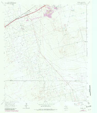
The industrial and ranching character of West Texas is clearly visible in this 1960s study of the Penwell area. The Texas and Pacific railroad serves as the primary corridor through the landscape, flanked by the small settlement of Badger and the community surrounding the Penwell Ch. A significant Refinery and an extensive network of pipelines reveal the importance of the local petroleum industry, which is further evidenced by clusters of Oil Wells and numerous named water sources such as Germany Wells and Yates Well.
Find a feature on this map
24 named features on this map. Tap any name to fly to it.
Don’t see what you’re looking for? This feature index may not catch every label — zoom into the map to look around manually.
Map Details
Editions of this 1964 Penwell Map
2 editions found
Other maps of this area

1954 · Pecos
USGS Topo · 1:250,000

1957 · Pecos
USGS Topo · 1:250,000

1964 · Odessa SW
USGS Topo · 1:24,000

1964 · Douro
USGS Topo · 1:24,000

1964 · Metz
USGS Topo · 1:24,000

1964 · Red Lakes
USGS Topo · 1:24,000

1964 · Doodle Bug Well
USGS Topo · 1:24,000

1964 · Penwell SW
USGS Topo · 1:24,000

1964 · Penwell SE
USGS Topo · 1:24,000

1964 · Clark Brothers Ranch
USGS Topo · 1:24,000