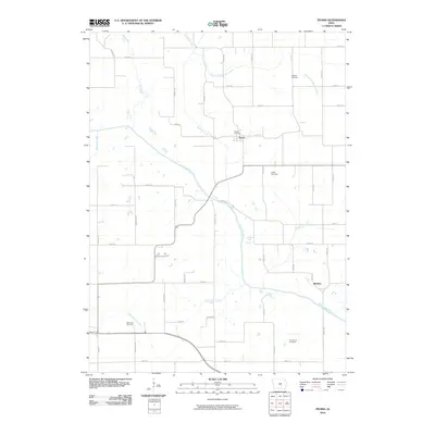
2010 Map of Peoria
USGS Topo · Published 2010About this map
The South Skunk River carves a diagonal path through this rural Iowa landscape, defining the local topography and drainage patterns for a series of smaller tributaries. The small settlement of Peoria serves as a primary local landmark, situated near the headwaters of Buckley Creek and its East Branch. Further south, the community of Bernina overlooks the river valley near the confluence of Ballinger Creek.
Find a feature on this map
41 named features on this map. Tap any name to fly to it.
Don’t see what you’re looking for? This feature index may not catch every label — zoom into the map to look around manually.
Map Details
Editions of this 2010 Peoria Map
This is the sole edition of this map. No revisions or reprints were ever made.
Other maps of this area

1910 · Pella
USGS Topo · 1:62,500

1912 · Pella
USGS Topo · 1:62,500

1954 · Des Moines
USGS Topo · 1:250,000

1956 · Des Moines
USGS Topo · 1:250,000

1957 · Des Moines
USGS Topo · 1:250,000

1968 · Oskaloosa
USGS Topo · 1:24,000

1969 · Des Moines
USGS Topo · 1:250,000

1979 · Searsboro
USGS Topo · 1:24,000
1980 · Leighton
USGS Topo · 1:24,000

1980 · Sully
USGS Topo · 1:24,000