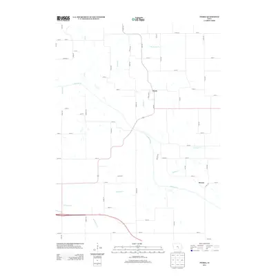
2013 Map of Peoria
USGS Topo · Published 2013About this map
S Skunk River meanders across this rural landscape, shaping the geography of Marion County's northern townships. The settlement of Peoria serves as a central hub for the surrounding agricultural community, where a grid of secondary roads connects scattered homesteads and small localities like Bernina and Castle Cor. This 2013 survey reflects a deeply entrenched rural structure where land divisions are defined by numerous watercourses, including Muchakinock Cr and Buckley Cr. The map captures a moment of transition for regional transit, documenting the established county highway system alongside the historic creek crossings that have dictated the placement of farms for generations. It provides a clear record of the watershed patterns that feed into the Skunk River, offering an essential view for those tracking family land or the evolution of Iowa's prairie townships.
Find a feature on this map
52 named features on this map. Tap any name to fly to it.
Don’t see what you’re looking for? This feature index may not catch every label — zoom into the map to look around manually.
Map Details
Editions of this 2013 Peoria Map
This is the sole edition of this map. No revisions or reprints were ever made.
Other maps of this area

1910 · Pella
USGS Topo · 1:62,500

1912 · Pella
USGS Topo · 1:62,500

1954 · Des Moines
USGS Topo · 1:250,000

1956 · Des Moines
USGS Topo · 1:250,000

1957 · Des Moines
USGS Topo · 1:250,000

1968 · Oskaloosa
USGS Topo · 1:24,000

1969 · Des Moines
USGS Topo · 1:250,000

1979 · Searsboro
USGS Topo · 1:24,000
1980 · Leighton
USGS Topo · 1:24,000

1980 · Sully
USGS Topo · 1:24,000