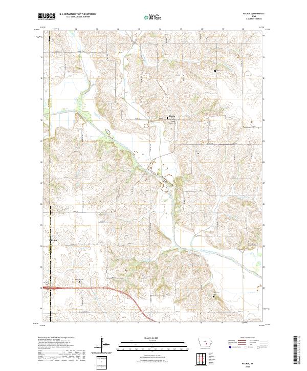
2022 Map of Peoria
USGS Topo · Published 2022About this map
The South Skunk River meanders diagonally through this agricultural landscape, defining the topography of northwestern Mahaska County. The unincorporated community of Peoria serves as a local hub, situated near its namesake Peoria Cem and surrounded by a network of sectional roads like Main St and Elba Ave. On the western edge, the outskirts of Pella begin to appear where the Marion County line meets Mahaska. The map reveals a high density of small burial grounds that mark early family settlements and rural congregations, including Baldwin Cem, Appel Cem, and Black Oak Cem. Waterways such as Muchakinock Cr and Ballinger Cr carve through the tillable land, while Castle Cor stands as a distinct landmark along the gravel road grid, illustrating the persistent 19th-century survey patterns in modern Iowa.
Find a feature on this map
56 named features on this map. Tap any name to fly to it.
Don’t see what you’re looking for? This feature index may not catch every label — zoom into the map to look around manually.
Map Details
Editions of this 2022 Peoria Map
This is the sole edition of this map. No revisions or reprints were ever made.
Other maps of this area

1910 · Pella
USGS Topo · 1:62,500

1912 · Pella
USGS Topo · 1:62,500

1954 · Des Moines
USGS Topo · 1:250,000

1956 · Des Moines
USGS Topo · 1:250,000

1957 · Des Moines
USGS Topo · 1:250,000

1968 · Oskaloosa
USGS Topo · 1:24,000

1969 · Des Moines
USGS Topo · 1:250,000

1979 · Searsboro
USGS Topo · 1:24,000
1980 · Leighton
USGS Topo · 1:24,000

1980 · Sully
USGS Topo · 1:24,000