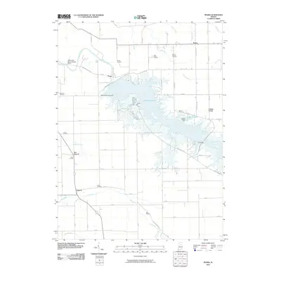
2010 Map of Peoria
USGS Topo · Published 2010About this map
Mississinewa Lake dominates the central portion of this Miami County landscape, created by the Mississinewa Lake Dam which spans the river just south of Peoria. This reservoir has reshaped the local geography, inundating lowlands and creating new shorelines near settlements like Red Bridge and College Corner. North of the water, the Mississinewa River retains its natural course, flowing past the Cliffs of the Seven Double Pillars, a distinctive geological formation along the riverbanks.
Find a feature on this map
35 named features on this map. Tap any name to fly to it.
Don’t see what you’re looking for? This feature index may not catch every label — zoom into the map to look around manually.
Map Details
Editions of this 2010 Peoria Map
This is the sole edition of this map. No revisions or reprints were ever made.
Other maps of this area

1951 · Peru
USGS Topo · 1:24,000

1951 · Bunker Hill
USGS Topo · 1:24,000

1951 · Richvalley
USGS Topo · 1:24,000

1952 · Wabash
USGS Topo · 1:24,000

1953 · Somerset
USGS Topo · 1:24,000

1953 · Peoria
USGS Topo · 1:24,000

1953 · Danville
USGS Topo · 1:250,000

1953 · Muncie
USGS Topo · 1:250,000

1955 · Danville
USGS Topo · 1:250,000

1956 · Muncie
USGS Topo · 1:250,000