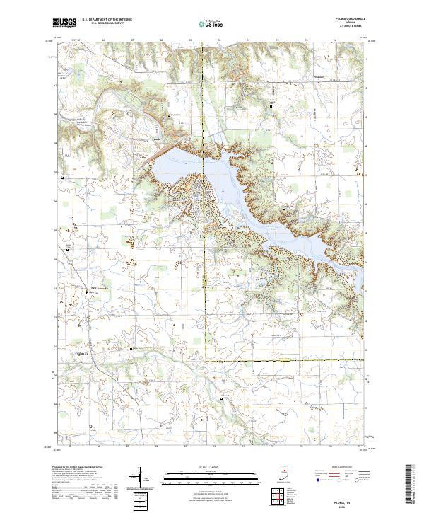
2022 Map of Peoria
USGS Topo · Published 2022About this map
The Mississinewa River and the expansive Mississinewa Lake anchor this portion of the Indiana landscape, where the waters cross the border between Miami and Wabash counties. The terrain is marked by significant geological and cultural landmarks, including the Cliffs of the Seven Double Pillars overlooking the river valley. A network of historical trails, such as the Frances Slocum Trl and Shepoconah Trl, trace the edges of the Mississinewa Lake shoreline and the adjacent state forest lands.
Find a feature on this map
57 named features on this map. Tap any name to fly to it.
Don’t see what you’re looking for? This feature index may not catch every label — zoom into the map to look around manually.
Map Details
Editions of this 2022 Peoria Map
This is the sole edition of this map. No revisions or reprints were ever made.
Other maps of this area

1951 · Peru
USGS Topo · 1:24,000

1951 · Bunker Hill
USGS Topo · 1:24,000

1951 · Richvalley
USGS Topo · 1:24,000

1952 · Wabash
USGS Topo · 1:24,000

1953 · Somerset
USGS Topo · 1:24,000

1953 · Peoria
USGS Topo · 1:24,000

1953 · Danville
USGS Topo · 1:250,000

1953 · Muncie
USGS Topo · 1:250,000

1955 · Danville
USGS Topo · 1:250,000

1956 · Muncie
USGS Topo · 1:250,000