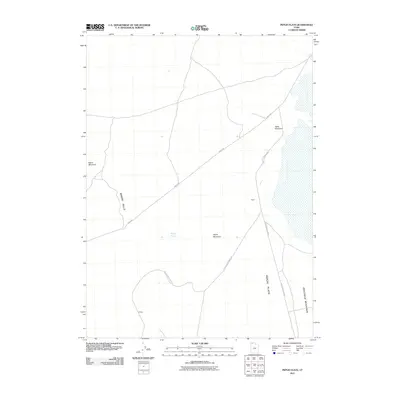
2011 Map of Peplin Flats
USGS Topo · Published 2011About this map
The vast, arid expanse of the Peplin Flats in Box Elder County defines this landscape, where the traces of historical transport intersect with desert terrain. The presence of the Old Railroad Grade Rd provides a clear marker of the early 20th-century rail infrastructure that once bridged these remote basins. Small settlements like Peplin and Ombey appear as isolated outposts within the wider geographic context of the Great Basin, situated near seasonal water features such as Peplin Pond.
Find a feature on this map
12 named features on this map. Tap any name to fly to it.
Don’t see what you’re looking for? This feature index may not catch every label — zoom into the map to look around manually.
Map Details
Editions of this 2011 Peplin Flats Map
This is the sole edition of this map. No revisions or reprints were ever made.
Other maps of this area

1954 · Brigham City
USGS Topo · 1:250,000

1958 · Brigham City
USGS Topo · 1:250,000

1959 · Kelton Pass
USGS Topo · 1:62,500

1959 · Park Valley
USGS Topo · 1:62,500

1962 · Brigham City
USGS Topo · 1:250,000

1969 · Peplin Flats
USGS Topo · 1:24,000

1969 · Crocodile Mtn NE
USGS Topo · 1:24,000

1969 · Hogup Bar
USGS Topo · 1:24,000
1969 · Crocodile Mtn SE
USGS Topo · 1:24,000

1971 · Matlin
USGS Topo · 1:24,000