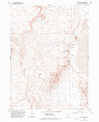
1991 Map of Peplin Flats
USGS Topo · Published 1992About this map
Peplin (Site) and Ombey (Site) anchor this 1991 topographic study of the arid Box Elder County basin, marking the locations of former habitations in a landscape now defined by cattle and mineral exploration. The terrain rises sharply from the broad Peplin Flats into the Baker Hills, culminating at Baker Mountain and Peplin Mtn. This area is characterized by its vital, if sparse, water sources including several Salt Springs and the small Peplin Pond. Evidence of historical industry persists through scattered Prospects and a remote Landing Strip near a corral. Notable geological features, such as a Natural Arch and the prominent Table Mtn, provide distinct landmarks across the desert floor and its surrounding bluffs.
Find a feature on this map
17 named features on this map. Tap any name to fly to it.
Don’t see what you’re looking for? This feature index may not catch every label — zoom into the map to look around manually.
Map Details
Editions of this 1991 Peplin Flats Map
This is the sole edition of this map. No revisions or reprints were ever made.
Other maps of this area

1954 · Brigham City
USGS Topo · 1:250,000

1958 · Brigham City
USGS Topo · 1:250,000

1959 · Kelton Pass
USGS Topo · 1:62,500

1959 · Park Valley
USGS Topo · 1:62,500

1962 · Brigham City
USGS Topo · 1:250,000

1969 · Peplin Flats
USGS Topo · 1:24,000

1969 · Crocodile Mtn NE
USGS Topo · 1:24,000

1969 · Hogup Bar
USGS Topo · 1:24,000
1969 · Crocodile Mtn SE
USGS Topo · 1:24,000

1971 · Matlin
USGS Topo · 1:24,000