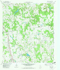
1982 Map of Percilla
USGS Topo · Published 1982About this map
The Slocum Oil Field dominates the northern reaches of this East Texas survey, where a landscape of derricks and extraction points meets a network of small rural congregations. The map records a deeply established community structure, marked by numerous small churches and family-linked chapels such as Guleyville Chapel and Fielders Chapel that dot the countryside between Salmon and Percilla. The topography is defined by the winding course of Ioni Creek and Murchison Creek, which carve through the terrain south toward Grapeland.
Find a feature on this map
35 named features on this map. Tap any name to fly to it.
Don’t see what you’re looking for? This feature index may not catch every label — zoom into the map to look around manually.
Map Details
Editions of this 1982 Percilla Map
This is the sole edition of this map. No revisions or reprints were ever made.
Other maps of this area

1950 · Crockett NE
USGS Topo · 1:24,000

1951 · Grapeland
USGS Topo · 1:24,000

1951 · Crockett NE
USGS Topo · 1:24,000

1951 · Elkhart
USGS Topo · 1:62,500

1952 · Slocum
USGS Topo · 1:62,500

1953 · Palestine
USGS Topo · 1:250,000

1957 · Palestine
USGS Topo · 1:250,000

1964 · Hays Spring
USGS Topo · 1:24,000

1981 · Palestine
USGS Topo · 1:100,000
1982 · Elkhart Creek
USGS Topo · 1:24,000