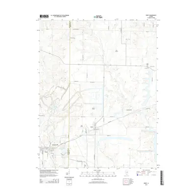
2015 Map of Percy
USGS Topo · Published 2015About this map
The village of Percy and the settlement of Cutler anchor this landscape along the border of Randolph Co and Perry Co. Large clearings like Sixmile Prairie and Lost Prairie reflect the region's agricultural roots, while modern developments appear in the form of the Southwestern Community Club Lake and Golf Course Lake. Local transportation is defined by a distinctively named road network, including Kangaroo Rd, Badger Rd, and Vole Rd.
Find a feature on this map
65 named features on this map. Tap any name to fly to it.
Don’t see what you’re looking for? This feature index may not catch every label — zoom into the map to look around manually.
Map Details
Editions of this 2015 Percy Map
This is the sole edition of this map. No revisions or reprints were ever made.
Other maps of this area

1910 · Murphysboro
USGS Topo · 1:62,500

1914 · Coulterville
USGS Topo · 1:62,500

1916 · Campbell Hill
USGS Topo · 1:62,500

1917 · Coulterville
USGS Topo · 1:62,500

1918 · Campbell Hill
USGS Topo · 1:62,500

1924 · Pinckneyville
USGS Topo · 1:62,500

1926 · Pinckneyville
USGS Topo · 1:62,500

1938 · Murphysboro
USGS Topo · 1:62,500

1949 · Paducah
USGS Topo · 1:250,000

1950 · Paducah
USGS Topo · 1:250,000