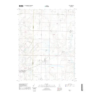
2018 Map of Percy
USGS Topo · Published 2018About this map
Percy and Cutler anchor the lower portion of this landscape at the intersection of Randolph and Perry counties. The terrain is a mix of agricultural expanses like Sixmile Prairie and areas of former surface mining, evidenced by the presence of W C Streamline Lake and E C Streamline Lake. The rural character of the region is preserved through numerous family-named roads and remote burial sites, including Saint Joseph Cem and Galum Baptist Cem, which offer significant value for genealogical research. Small settlements such as Jamestown and Lost Prairie are scattered across the northern sections, while Hepp Airport serves as a local aviation landmark. Drainage is provided by Galum Cr and Pipestone Cr, which wind through the township boundaries.
Find a feature on this map
65 named features on this map. Tap any name to fly to it.
Don’t see what you’re looking for? This feature index may not catch every label — zoom into the map to look around manually.
Map Details
Editions of this 2018 Percy Map
This is the sole edition of this map. No revisions or reprints were ever made.
Other maps of this area

1910 · Murphysboro
USGS Topo · 1:62,500

1914 · Coulterville
USGS Topo · 1:62,500

1916 · Campbell Hill
USGS Topo · 1:62,500

1917 · Coulterville
USGS Topo · 1:62,500

1918 · Campbell Hill
USGS Topo · 1:62,500

1924 · Pinckneyville
USGS Topo · 1:62,500

1926 · Pinckneyville
USGS Topo · 1:62,500

1938 · Murphysboro
USGS Topo · 1:62,500

1949 · Paducah
USGS Topo · 1:250,000

1950 · Paducah
USGS Topo · 1:250,000