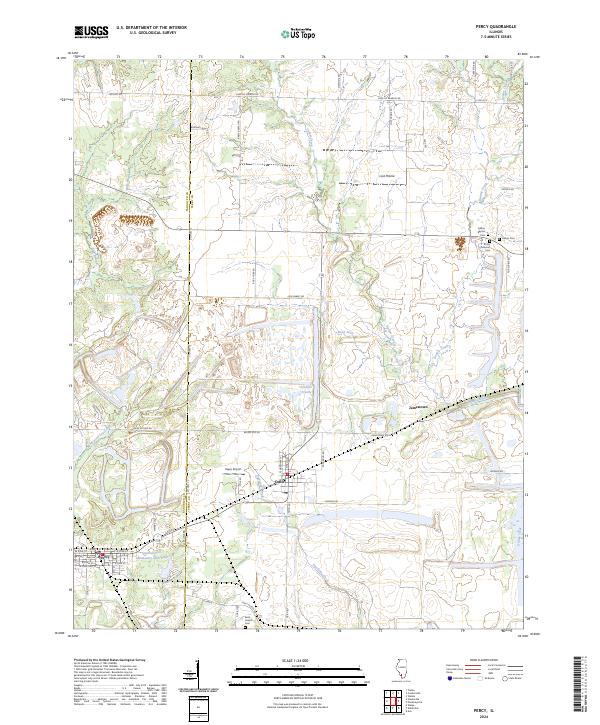
2024 Map of Percy
USGS Topo · Published 2024About this map
Cutler and Percy serve as the primary hubs of this landscape straddling the Randolph and Perry County line. The area is defined by its agrarian character and established rural networks, featuring smaller points of interest like Jamestown and Lost Prairie. Local genealogy is well-documented through several historic burial grounds, including Galum Baptist Cem and Trinity Lutheran Cem, alongside Saint Joseph Cem further south.
Find a feature on this map
55 named features on this map. Tap any name to fly to it.
Don’t see what you’re looking for? This feature index may not catch every label — zoom into the map to look around manually.
Map Details
Editions of this 2024 Percy Map
This is the sole edition of this map. No revisions or reprints were ever made.
Other maps of this area

1910 · Murphysboro
USGS Topo · 1:62,500

1914 · Coulterville
USGS Topo · 1:62,500

1916 · Campbell Hill
USGS Topo · 1:62,500

1917 · Coulterville
USGS Topo · 1:62,500

1918 · Campbell Hill
USGS Topo · 1:62,500

1924 · Pinckneyville
USGS Topo · 1:62,500

1926 · Pinckneyville
USGS Topo · 1:62,500

1938 · Murphysboro
USGS Topo · 1:62,500

1949 · Paducah
USGS Topo · 1:250,000

1950 · Paducah
USGS Topo · 1:250,000