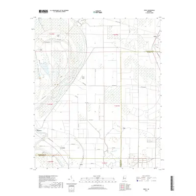
2018 Map of Percy
USGS Topo · Published 2018About this map
Steele Bayou and Deer Creek wind through this alluvial landscape at the intersection of Washington, Sharkey, and Issaquena counties. The area is defined by its complex hydrology, featuring numerous oxbows and sloughs such as Swan Lake, Gin Slough, and Lizard Lake that testify to the shifting historical paths of the Delta's watercourses. Small agricultural settlements like Percy, Grace, and Sago are linked by a grid of rural roads, including Mound Spencer Road and Beargarden Road.
Find a feature on this map
57 named features on this map. Tap any name to fly to it.
Don’t see what you’re looking for? This feature index may not catch every label — zoom into the map to look around manually.
Map Details
Editions of this 2018 Percy Map
This is the sole edition of this map. No revisions or reprints were ever made.
Other maps of this area

1909 · Wilsons Point
USGS Topo · 1:24,000

1913 · Wilson Point
USGS Topo · 1:31,680

1939 · Lorenzen
USGS Topo · 1:62,500

1939 · Readland
USGS Topo · 1:62,500

1939 · Mayersville
USGS Topo · 1:62,500

1939 · Swan Lake
USGS Topo · 1:62,500

1953 · Greenwood
USGS Topo · 1:250,000

1955 · Jackson
USGS Topo · 1:250,000

1956 · Greenwood
USGS Topo · 1:250,000

1961 · Jackson
USGS Topo · 1:250,000