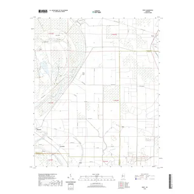
2020 Map of Percy
USGS Topo · Published 2020About this map
Yazoo National Wildlife Refuge dominates the landscape of this Mississippi Delta region, preserving a complex network of wetlands and waterways. The map illustrates a high concentration of oxbow features and sluggish water bodies, including Swan Lake, Lizard Lake, and Long Pond, which indicate the shifting course of the nearby river systems. This environment is defined by its seasonal hydrology, where features like Deer Lake Slough and Hools Dump Slough crisscross the low-lying terrain.
Find a feature on this map
53 named features on this map. Tap any name to fly to it.
Don’t see what you’re looking for? This feature index may not catch every label — zoom into the map to look around manually.
Map Details
Editions of this 2020 Percy Map
This is the sole edition of this map. No revisions or reprints were ever made.
Other maps of this area

1909 · Wilsons Point
USGS Topo · 1:24,000

1913 · Wilson Point
USGS Topo · 1:31,680

1939 · Lorenzen
USGS Topo · 1:62,500

1939 · Readland
USGS Topo · 1:62,500

1939 · Mayersville
USGS Topo · 1:62,500

1939 · Swan Lake
USGS Topo · 1:62,500

1953 · Greenwood
USGS Topo · 1:250,000

1955 · Jackson
USGS Topo · 1:250,000

1956 · Greenwood
USGS Topo · 1:250,000

1961 · Jackson
USGS Topo · 1:250,000