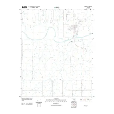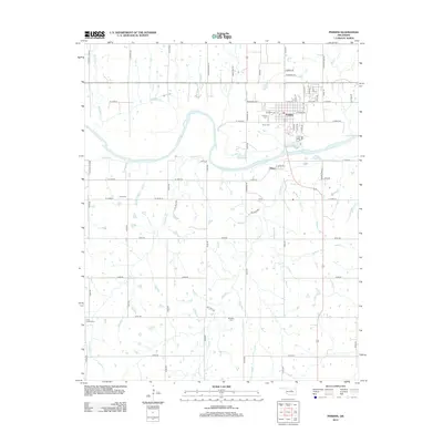
2022 Map of Perkins
USGS Topo · Published 2022About this map
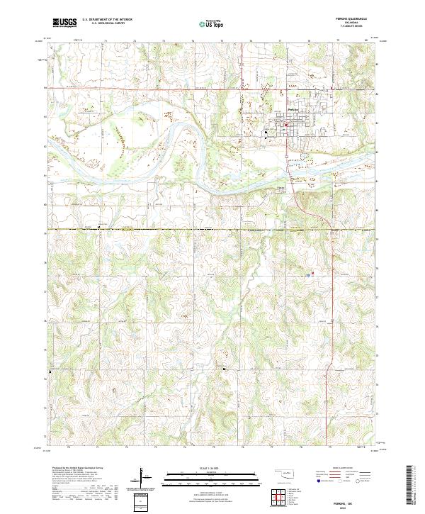
The Cimarron River carves a broad valley through the center of this terrain, separating the established town of Perkins from the smaller settlement of Vinco to the southeast. This modern survey illustrates the persistent agricultural and cemetery patterns of the region, where family and community heritage is anchored by landmarks like Olivet Cem, Knipe Cem, and Brandon Cem. The southern edge of the map, spanning the Payne and Lincoln County line, includes the Iowa Chapel Cem, reflecting the early settlement history along the drainage of Corduroy Cr. Smaller water bodies such as Twin Lakes and several unnamed reservoirs suggest a landscape managed for cattle and irrigation. The road network, composed of long section-line routes like Goodnight Rd and Jog Line Rd, highlights the grid-based development typical of the Oklahoma territory's historical land runs.
Find a feature on this map
65 named features on this map. Tap any name to fly to it.
Don’t see what you’re looking for? This feature index may not catch every label — zoom into the map to look around manually.
Map Details
Editions of this 2022 Perkins Map
This is the sole edition of this map. No revisions or reprints were ever made.
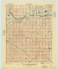
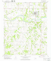
Historical Maps of Perkins Through Time
7 maps found