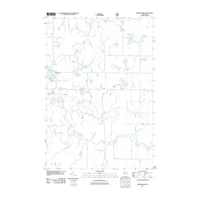
2011 Map of Perkinstown
USGS Topo · Published 2011About this map
Perkinstown serves as the focal point for this section of Taylor County, characterized by its numerous small glacial lakes and dense forest management infrastructure. The settlement is anchored by local landmarks such as the Perkinstown Cemetery and the Perkinstown Lookout Tower, reflecting its role as a hub for both community history and regional forestry oversight. The landscape is heavily defined by the upper reaches of the South Fork Yellow River and the Black River, alongside a complex network of forest roads like Forest Rd 554 and Forest Rd 553. Recreational and natural sites are prominent, including the Kathryn Lake Campground and a multitude of water bodies such as Hulls Lake, Lake Nineteen, and Kathryn Lake, which suggest a terrain shaped by logging and outdoor activity.
Find a feature on this map
56 named features on this map. Tap any name to fly to it.
Don’t see what you’re looking for? This feature index may not catch every label — zoom into the map to look around manually.
Map Details
Editions of this 2011 Perkinstown Map
This is the sole edition of this map. No revisions or reprints were ever made.
Other maps of this area

1944 · Ogema
USGS Topo · 1:48,000

1945 · Black River
USGS Topo · 1:48,000

1947 · Ogema
USGS Topo · 1:48,000

1949 · Ogema
USGS Topo · 1:48,000

1949 · Jump River Fire Tower
USGS Topo · 1:48,000

1951 · Lublin
USGS Topo · 1:48,000

1951 · Medford
USGS Topo · 1:48,000

1953 · Rice Lake
USGS Topo · 1:250,000

1959 · Rice Lake
USGS Topo · 1:250,000

1969 · Perkinstown
USGS Topo · 1:24,000