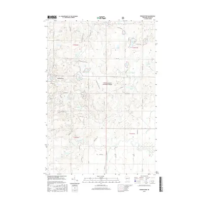
2015 Map of Perkinstown
USGS Topo · Published 2015About this map
Perkinstown serves as the primary settlement within this glacial landscape of Taylor County, characterized by an exceptional density of kettle lakes and wetlands. The map shows a region heavily managed for recreation and conservation, dominated by the Chequamegon National Forest. The Ice Age National Scenic Trail winds through the center of the sheet, tracing the terminal moraine past water bodies like Kathryn Lake, Richter Lake, and Lake Eleven. In the southeast, the Black River originates among these marshes, while the northern sections drain toward the S Fork Yellow River. This 2015 survey provides a modern snapshot of the area's transition from early logging history—evidenced by the Perkinstown Cem—to its contemporary role as a seasonal retreat, with residential clusters at Whispering Pines and recreational hubs near Hulls Lake.
Find a feature on this map
70 named features on this map. Tap any name to fly to it.
Don’t see what you’re looking for? This feature index may not catch every label — zoom into the map to look around manually.
Map Details
Editions of this 2015 Perkinstown Map
This is the sole edition of this map. No revisions or reprints were ever made.
Other maps of this area

1944 · Ogema
USGS Topo · 1:48,000

1945 · Black River
USGS Topo · 1:48,000

1947 · Ogema
USGS Topo · 1:48,000

1949 · Ogema
USGS Topo · 1:48,000

1949 · Jump River Fire Tower
USGS Topo · 1:48,000

1951 · Lublin
USGS Topo · 1:48,000

1951 · Medford
USGS Topo · 1:48,000

1953 · Rice Lake
USGS Topo · 1:250,000

1959 · Rice Lake
USGS Topo · 1:250,000

1969 · Perkinstown
USGS Topo · 1:24,000