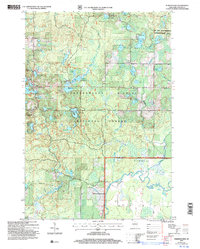
2005 Map of Perkinstown
USGS Topo · Published 2006About this map
Perkinstown and its surrounding wetlands occupy this 2005 revision of the 1965 topography, situated within the Chequamegon Nicolet National Forest. The landscape is a dense network of glacial lakes and kettle holes, ranging from Kathryn Lake near the settlement to the more secluded Lake Eleven and Hulls Lake. The drainage is defined by the Black River and the Yellow River Fork, winding through a mix of marshy lowlands and forested ridges.
Find a feature on this map
38 named features on this map. Tap any name to fly to it.
Don’t see what you’re looking for? This feature index may not catch every label — zoom into the map to look around manually.
Map Details
Editions of this 2005 Perkinstown Map
This is the sole edition of this map. No revisions or reprints were ever made.
Other maps of this area

1944 · Ogema
USGS Topo · 1:48,000

1945 · Black River
USGS Topo · 1:48,000

1947 · Ogema
USGS Topo · 1:48,000

1949 · Ogema
USGS Topo · 1:48,000

1949 · Jump River Fire Tower
USGS Topo · 1:48,000

1951 · Lublin
USGS Topo · 1:48,000

1951 · Medford
USGS Topo · 1:48,000

1953 · Rice Lake
USGS Topo · 1:250,000

1959 · Rice Lake
USGS Topo · 1:250,000

1969 · Perkinstown
USGS Topo · 1:24,000