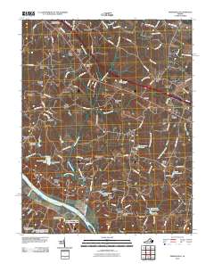
2010 Map of Perkinsville
USGS Topo · Published 2010About this map
Virginia State Farm dominates the southern landscape along the northern bank of the James River in this Goochland County region. The terrain is defined by its water management and agricultural history, featuring a series of reservoirs including Mount Bernard Lake and Amber Lake, alongside several man-made structures like Bowles Dam and Richmonds Dam. Settlement patterns here reflect a mix of historic outposts and modern residential enclaves, with the Crozier Post Office serving as a central community point near Crozier.
Find a feature on this map
113 named features on this map. Tap any name to fly to it.
Don’t see what you’re looking for? This feature index may not catch every label — zoom into the map to look around manually.
Map Details
Editions of this 2010 Perkinsville Map
This is the sole edition of this map. No revisions or reprints were ever made.
Other maps of this area

1890 · Goochland
USGS Topo · 1:125,000

1892 · Goochland
USGS Topo · 1:125,000

1943 · Goochland
USGS Topo · 1:31,680

1943 · Mabelton
USGS Topo · 1:31,680

1943 · Fine Creek Mills
USGS Topo · 1:31,680

1943 · Powhatan
USGS Topo · 1:31,680

1943 · Perkinsville
USGS Topo · 1:31,680

1943 · South Anna
USGS Topo · 1:24,000
1943 · Dabneys
USGS Topo · 1:24,000

1943 · Midlothian
USGS Topo · 1:24,000