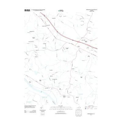
2013 Map of Perkinsville
USGS Topo · Published 2013About this map
The James River forms the southern boundary of this central Virginia landscape, where agricultural tradition meets modern suburban growth in Goochland County. A significant portion of the riverfront is occupied by the Virginia State Farm Penal Institution and the State Farm grounds, established features that have long influenced the local land use and economy. To the north, the terrain rises into the Horsepen Hills, with the community of Oilville serving as a primary corridor along the historic Broad Street Rd.
Find a feature on this map
119 named features on this map. Tap any name to fly to it.
Don’t see what you’re looking for? This feature index may not catch every label — zoom into the map to look around manually.
Map Details
Editions of this 2013 Perkinsville Map
This is the sole edition of this map. No revisions or reprints were ever made.
Other maps of this area

1890 · Goochland
USGS Topo · 1:125,000

1892 · Goochland
USGS Topo · 1:125,000

1943 · Goochland
USGS Topo · 1:31,680

1943 · Mabelton
USGS Topo · 1:31,680

1943 · Fine Creek Mills
USGS Topo · 1:31,680

1943 · Powhatan
USGS Topo · 1:31,680

1943 · Perkinsville
USGS Topo · 1:31,680

1943 · South Anna
USGS Topo · 1:24,000
1943 · Dabneys
USGS Topo · 1:24,000

1943 · Midlothian
USGS Topo · 1:24,000