
1943 Map of Perkinsville
USGS Topo · Published 1943About this map
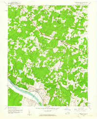
The James River corridor in Goochland County defines the southern boundary of this region during the early 1940s, where the Chesapeake and Ohio railroad tracks parallel the water. The landscape is dotted with small rural centers and family-named landmarks like Gammons Store and Thorncliff. Significant social and institutional footprints are evident at State Farm, which includes a dedicated Sewage Disposal facility. Inland, the community structure is anchored by several houses of worship, including Epis Church, Bethel Church, and Hebron Church. Numerous waterways such as Beaverdam Creek and Turkey Creek cut through the terrain, illustrating the drainage patterns that influenced the placement of settlements like Perkinsville, Oilville, and Cardwell along the established roadway network.
Find a feature on this map
21 named features on this map. Tap any name to fly to it.
Don’t see what you’re looking for? This feature index may not catch every label — zoom into the map to look around manually.
Map Details
Editions of this 1943 Perkinsville Map
2 editions found
Other maps of this area

1890 · Goochland
USGS Topo · 1:125,000

1892 · Goochland
USGS Topo · 1:125,000

1943 · Goochland
USGS Topo · 1:31,680

1943 · Mabelton
USGS Topo · 1:31,680

1943 · Fine Creek Mills
USGS Topo · 1:31,680

1943 · Powhatan
USGS Topo · 1:31,680

1943 · South Anna
USGS Topo · 1:24,000
1943 · Dabneys
USGS Topo · 1:24,000

1943 · Midlothian
USGS Topo · 1:24,000
1943 · Johnsons Springs
USGS Topo · 1:24,000