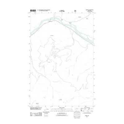
2011 Map of Perma
USGS Topo · Published 2011About this map
The Flathead River carves a sweeping path through the northern reach of this Montana landscape, where the small settlement of Perma sits along its banks. This 2011 survey captures a region defined by complex drainage patterns and significant elevation changes, ranging from the river valley up to prominent summits like Three Lakes Peak and Burnt Fork Pinnacle. A network of Forest Service roads, including the Vanderburg Creek Rd and numerous numbered Dixon routes, provides access to the high country and the Forest Service Winter Range.
Find a feature on this map
30 named features on this map. Tap any name to fly to it.
Don’t see what you’re looking for? This feature index may not catch every label — zoom into the map to look around manually.
Map Details
Editions of this 2011 Perma Map
This is the sole edition of this map. No revisions or reprints were ever made.
Other maps of this area

1956 · Wallace
USGS Topo · 1:250,000

1959 · Tarkio
USGS Topo · 1:62,500

1959 · Alberton
USGS Topo · 1:62,500

1959 · Perma
USGS Topo · 1:62,500

1960 · Wallace
USGS Topo · 1:250,000

1964 · Mc Donald
USGS Topo · 1:24,000

1964 · Melton Ranch
USGS Topo · 1:24,000

1983 · Horsehead Peak
USGS Topo · 1:24,000

1984 · Stark North
USGS Topo · 1:24,000
1984 · Mc Cormick Peak
USGS Topo · 1:24,000