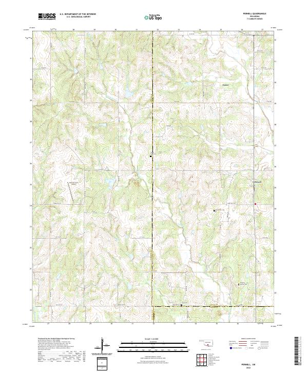
2022 Map of Pernell
USGS Topo · Published 2022About this map
Pernell, Foster, and Tussy anchor this rural landscape in south-central Oklahoma, situated at the crossroads of Stephens, Garvin, and Carter counties. The terrain is defined by the winding paths of Sandy Bear Cr, Salt Cr, and Black Bear Cr, which dictate the placement of local roads and family-named landmarks. Genealogists will find significant value in the documentation of several local burial grounds, including Sandy Bear Cem, Robberson Cem, Tussy Cem, and Dripping Springs Cem, which are scattered throughout the hills. The presence of the Newman Farm Airport west of Pernell highlights the region's historical reliance on local aviation for agricultural and transport needs. This survey details the established sections and ranges of the early 21st century, showing how property lines and secondary routes like Camel Back Rd and Baseline Rd continue to follow the foundational township system.
Find a feature on this map
32 named features on this map. Tap any name to fly to it.
Don’t see what you’re looking for? This feature index may not catch every label — zoom into the map to look around manually.
Map Details
Editions of this 2022 Pernell Map
This is the sole edition of this map. No revisions or reprints were ever made.
Other maps of this area

1898 · Pauls Valley
USGS Topo · 1:125,000

1901 · Addington
USGS Topo · 1:125,000

1901 · Ardmore
USGS Topo · 1:125,000

1902 · Pauls Valley
USGS Topo · 1:125,000

1902 · Rush Springs
USGS Topo · 1:125,000

1918 · Ardmore
USGS Topo · 1:125,000

1957 · Ardmore
USGS Topo · 1:250,000

1963 · Ardmore
USGS Topo · 1:250,000
1969 · Elmore City North
USGS Topo · 1:24,000
1969 · Elmore City South
USGS Topo · 1:24,000