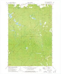
1973 Map of Perote Lake
USGS Topo · Published 1977About this map
The Menominee Indian Reservation occupies the majority of this northern Wisconsin landscape, characterized by an intricate network of glacial lakes and river systems. The drainage is dominated by the West Branch Wolf River and the Little West Branch Wolf River, which wind through the forested terrain alongside smaller tributaries like Tourtillotte Creek and Squaw Creek. Human activity is marked by the presence of several extraction sites, including a Sandpit and multiple Gravel Pits, while the Dutchman Lookout Tower stands as a notable landmark in the southwest.
Find a feature on this map
28 named features on this map. Tap any name to fly to it.
Don’t see what you’re looking for? This feature index may not catch every label — zoom into the map to look around manually.
Map Details
Editions of this 1973 Perote Lake Map
This is the sole edition of this map. No revisions or reprints were ever made.
Other maps of this area

1952 · White Lake
USGS Topo · 1:48,000

1952 · Langlade
USGS Topo · 1:48,000

1954 · Gresham
USGS Topo · 1:48,000

1954 · Shawano
USGS Topo · 1:48,000

1954 · Iron Mountain
USGS Topo · 1:250,000

1955 · Green Bay
USGS Topo · 1:250,000

1959 · Iron Mountain
USGS Topo · 1:250,000

1964 · Shawano
USGS Topo · 1:62,500

1964 · Gresham
USGS Topo · 1:62,500
1973 · Langlade
USGS Topo · 1:24,000