
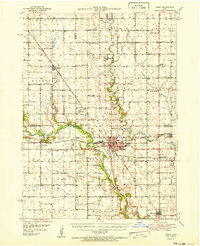
1951 Map of Perry
USGS Topo · Published 1951About this map
The North Raccoon River and Beaver Creek define the agricultural landscape of this central Iowa region in the early 1950s. The city of Perry serves as a significant rail hub, where the Chicago Milwaukee St Paul and Pacific meets the Minneapolis and St Louis line. This survey details the rural infrastructure of the era, recording numerous country schools like Prairie View Sch and Lincoln Sch, along with several Inactive Mine sites near Angus that speak to the area's earlier coal mining history.
Find a feature on this map
55 named features on this map. Tap any name to fly to it.
Don’t see what you’re looking for? This feature index may not catch every label — zoom into the map to look around manually.
Map Details
Editions of this 1951 Perry Map
2 editions found
Other maps of this area

1908 · Waukee
USGS Topo · 1:62,500

1911 · Madrid
USGS Topo · 1:62,500

1914 · Madrid
USGS Topo · 1:62,500

1916 · Boone
USGS Topo · 1:62,500

1949 · Adel
USGS Topo · 1:62,500

1950 · Perry
USGS Topo · 1:62,500

1951 · Ogden
USGS Topo · 1:62,500

1951 · Adel
USGS Topo · 1:62,500

1952 · Panora
USGS Topo · 1:62,500

1954 · Bagley
USGS Topo · 1:62,500