
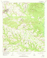
1956 Map of Perry
USGS Topo · Published 1957About this map
Perry serves as the regional hub for central Georgia on this mid-1950s survey, showing a landscape defined by the intersection of the Central and Southern railroads. The area's social fabric is visible through a dense network of rural community landmarks, including the County Training Sch, Southside Sch, and numerous churches such as Laidler Springs Ch and Green Grove Ch. To the east, the Ocmulgee River forms the natural boundary, while the industrial character of the era is marked by several Strip Mines operating near Clinchfield. The map reveals a transition from the larger settlement at Perry to smaller rural outposts like Elko, Grovania, and Hayneville. Local researchers can trace family roots through many small burial sites and specific family-named landmarks like Walnut Cem and the Kathleen Observation Tower.
Find a feature on this map
56 named features on this map. Tap any name to fly to it.
Don’t see what you’re looking for? This feature index may not catch every label — zoom into the map to look around manually.
Map Details
Editions of this 1956 Perry Map
2 editions found
Other maps of this area

1956 · Fort Valley
USGS Topo · 1:62,500

1956 · Cochran
USGS Topo · 1:62,500

1956 · Warner Robins
USGS Topo · 1:62,500

1956 · Jeffersonville
USGS Topo · 1:62,500

1957 · Macon
USGS Topo · 1:250,000

1958 · Macon
USGS Topo · 1:250,000

1964 · Macon
USGS Topo · 1:250,000

1971 · Pineview NW
USGS Topo · 1:24,000

1971 · Henderson
USGS Topo · 1:24,000

1971 · Pinehurst
USGS Topo · 1:24,000