Loading...
Loading map...2023 Map of Perry
USGS Topo · Published 2023About this map
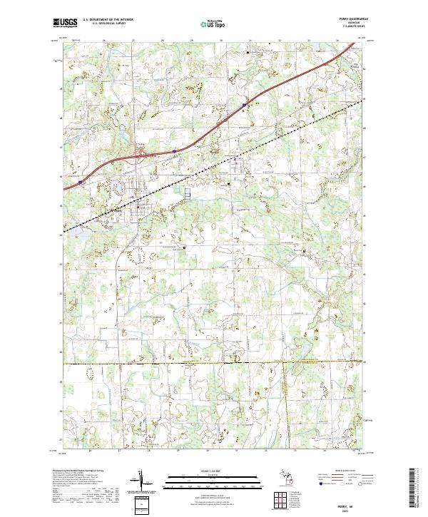
Perry and Morrice serve as the primary hubs of this landscape, situated near the headwaters of several drainage systems. The terrain is defined by a dense network of agricultural and municipal drains, such as the Kellogg Drain and Devore Drain, which feed into larger watercourses like the Looking Glass River and Vermilion Creek. This intricate water management system suggests a long-standing commitment to land reclamation for farming in the region.
Find a feature on this map
62 named features on this map. Tap any name to fly to it.
Don’t see what you’re looking for? This feature index may not catch every label — zoom into the map to look around manually.
Map Details
Date Portrayed2023
Date Published2023
PublisherU.S. Geological Survey
Map TypeTopographic
Scale1:24000
Physical Dimensions24 x 29 inches
Editions of this 2023 Perry Map
This is the sole edition of this map. No revisions or reprints were ever made.
Historical Maps of Morrice Through Time
Featured Locations
Source Details
SourceU.S. Geological Survey
CopyrightPublic Domain