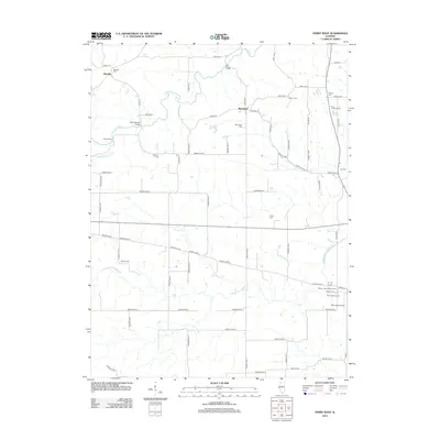
2012 Map of Perry West
USGS Topo · Published 2012About this map
McKee Cr and its tributaries, including Bower Cr and Middle Fork McKee Cr, define the drainage of this rural landscape in western Illinois. Small settlements such as Benville and Morrelville are situated among a network of township roads that follow the section lines of the early American land survey. For genealogists, the map is a dense record of early burial grounds, featuring more than a dozen named sites including the Hebron Cem, Stoner Cem, and the Zion Lutheran Cem. The terrain is marked by traditional river crossings and landmarks like Wilson Ford and the Shinnebarber Bridge. The eastern edge of the quadrangle shows the transition into more contemporary infrastructure with the Mountain Airport and the outskirts of the Perry community along Maine St.
Find a feature on this map
76 named features on this map. Tap any name to fly to it.
Don’t see what you’re looking for? This feature index may not catch every label — zoom into the map to look around manually.
Map Details
Editions of this 2012 Perry West Map
This is the sole edition of this map. No revisions or reprints were ever made.
Other maps of this area

1924 · Griggsville
USGS Topo · 1:62,500

1926 · Griggsville
USGS Topo · 1:62,500

1926 · Pittsfield
USGS Topo · 1:62,500

1926 · Mt Sterling
USGS Topo · 1:62,500

1928 · Meredosia
USGS Topo · 1:62,500

1929 · Mt Sterling
USGS Topo · 1:62,500

1931 · Meredosia
USGS Topo · 1:62,500

1948 · Quincy
USGS Topo · 1:250,000

1956 · Quincy
USGS Topo · 1:250,000
1980 · Perry East
USGS Topo · 1:24,000