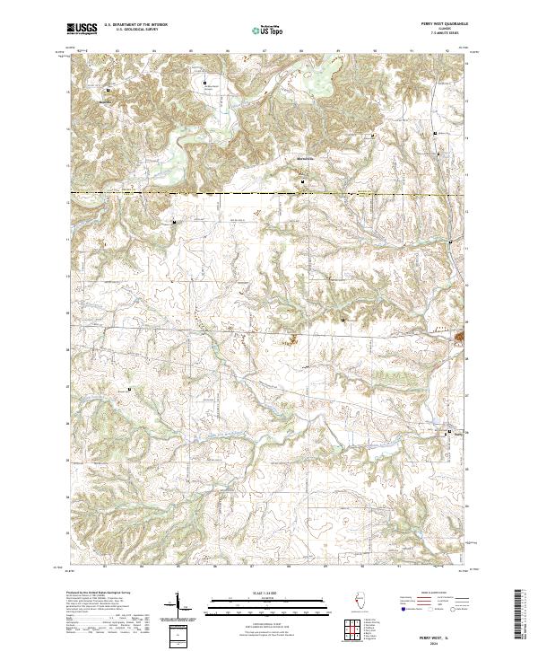
2024 Map of Perry West
USGS Topo · Published 2024About this map
The Brown and Pike county line divides this Illinois landscape, where the meandering course of McKee Creek and the Middle Fork McKee Creek shape the rural topography. The area is defined by a high density of ancestral burial sites, indicating a long-established network of family farmsteads and small communities. While the village of Perry sits at the eastern edge, smaller crossroads like Benville and Morrelville anchor the western reaches. Genealogists will find an exceptional density of small cemeteries, including the Jackson Burial Ground, Stoner Cem, and Hebron Cem, scattered among the rolling draws of Bower Creek and Rattlesnake Dens Creek. The grid of township roads, such as Twp Rd 2950 N and Co Hwy 19, provides a clear view of the agricultural parcels and drainage patterns that have persisted through generations of midwestern farming.
Find a feature on this map
80 named features on this map. Tap any name to fly to it.
Don’t see what you’re looking for? This feature index may not catch every label — zoom into the map to look around manually.
Map Details
Editions of this 2024 Perry West Map
This is the sole edition of this map. No revisions or reprints were ever made.
Other maps of this area

1924 · Griggsville
USGS Topo · 1:62,500

1926 · Griggsville
USGS Topo · 1:62,500

1926 · Pittsfield
USGS Topo · 1:62,500

1926 · Mt Sterling
USGS Topo · 1:62,500

1928 · Meredosia
USGS Topo · 1:62,500

1929 · Mt Sterling
USGS Topo · 1:62,500

1931 · Meredosia
USGS Topo · 1:62,500

1948 · Quincy
USGS Topo · 1:250,000

1956 · Quincy
USGS Topo · 1:250,000
1980 · Perry East
USGS Topo · 1:24,000