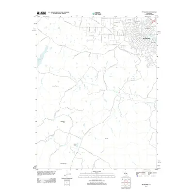
2012 Map of Petaluma
USGS Topo · Published 2012About this map
The Petaluma River winds through the heart of the city, defining the industrial and residential boundaries of early 21st-century Petaluma. This survey documents the transition from the dense urban grid of the historic center and East Petaluma to the expansive ranch lands and dairy country to the west and south. Notable burial sites including Cypress Hill Memorial Park, B'nai Israel Cem, and Petaluma Calvary Cem are situated on the northern edge of the settlement near the Sonoma-Marin Fairgrounds. Beyond the town limits, the landscape is marked by prominent peaks and valleys, including Antonio Mountain, Hicks Mountain, and the agricultural expanse of Hicks Valley. Waterways like San Antonio Cr and Arroyo Sausal drain the western hills toward the river valley, illustrating the local topography that has shaped Sonoma County's agricultural development.
Find a feature on this map
61 named features on this map. Tap any name to fly to it.
Don’t see what you’re looking for? This feature index may not catch every label — zoom into the map to look around manually.
Map Details
Editions of this 2012 Petaluma Map
This is the sole edition of this map. No revisions or reprints were ever made.
Other maps of this area

1914 · Petaluma
USGS Topo · 1:62,500

1916 · Santa Rosa
USGS Topo · 1:62,500

1916 · Point Reyes
USGS Topo · 1:48,000

1918 · Point Reyes
USGS Topo · 1:62,500

1935 · Sebastopol
USGS Topo · 1:48,000

1942 · Sebastopol
USGS Topo · 1:62,500

1942 · Petaluma
USGS Topo · 1:62,500

1944 · Santa Rosa
USGS Topo · 1:62,500

1947 · Santa Rosa
USGS Topo · 1:250,000

1949 · Santa Rosa
USGS Topo · 1:250,000