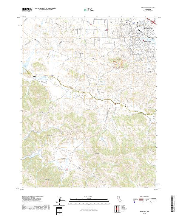
2021 Map of Petaluma
USGS Topo · Published 2021About this map
The Petaluma River winds through the heart of Petaluma, defining the urban center with industrial and maritime features like the McNear Peninsula and McNear Channel. This portion of Sonoma and Marin counties showcases a distinct transition from the dense street grid of the city, lined with roads such as Bodega Ave and Western Ave, into the expansive ranch lands of Chileno Valley and Hicks Valley. To the north, a significant cluster of memorial sites, including Cypress Hill Memorial Park, Bnai Israel Cem, and Calvary Cem, serves as a vital resource for genealogical research.
Find a feature on this map
118 named features on this map. Tap any name to fly to it.
Don’t see what you’re looking for? This feature index may not catch every label — zoom into the map to look around manually.
Map Details
Editions of this 2021 Petaluma Map
This is the sole edition of this map. No revisions or reprints were ever made.
Other maps of this area

1914 · Petaluma
USGS Topo · 1:62,500

1916 · Santa Rosa
USGS Topo · 1:62,500

1916 · Point Reyes
USGS Topo · 1:48,000

1918 · Point Reyes
USGS Topo · 1:62,500

1935 · Sebastopol
USGS Topo · 1:48,000

1942 · Sebastopol
USGS Topo · 1:62,500

1942 · Petaluma
USGS Topo · 1:62,500

1944 · Santa Rosa
USGS Topo · 1:62,500

1947 · Santa Rosa
USGS Topo · 1:250,000

1949 · Santa Rosa
USGS Topo · 1:250,000