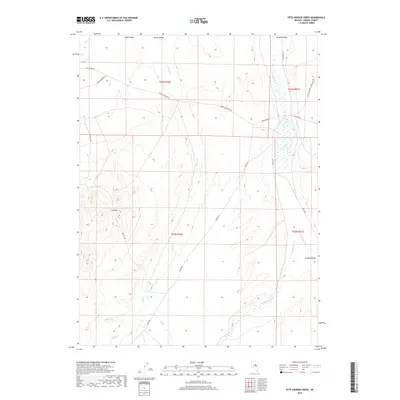
2018 Map of Pete Hanson Creek
USGS Topo · Published 2018About this map
Pine Valley and Garden Valley dominate this high-desert landscape in central Nevada, where drainage patterns are defined by seasonal waterways like Pete Hanson Cr and Henderson Cr. The topography is anchored by the prominent Red Hill, which overlooks a network of ranch and mineral roads that historically supported the region's mining and grazing activities. Notable transportation corridors include Cortez Beowawe Rd and Buckhorn Rd, which cut across the valleys to connect remote outposts. Small creek systems such as Denay Cr, Pine Cr, and Geyser Cr offer insight into the precarious water sources of this arid terrain. This 2018 survey documents the enduring physical character of Eureka County's interior, showing the persistent rural infrastructure of Alpha Rd and Tonkin Rd amidst the vast basin and range geography.
Find a feature on this map
22 named features on this map. Tap any name to fly to it.
Don’t see what you’re looking for? This feature index may not catch every label — zoom into the map to look around manually.
Map Details
Editions of this 2018 Pete Hanson Creek Map
This is the sole edition of this map. No revisions or reprints were ever made.
Other maps of this area

1926 · Roberts Mountains
USGS Topo · 1:250,000

1929 · Roberts Mountains
USGS Topo · 1:250,000

1937 · Mineral Hill
USGS Topo · 1:48,000

1943 · Mineral Hill
USGS Topo · 1:62,500

1949 · Garden Valley
USGS Topo · 1:62,500

1949 · Roberts Creek Mtn
USGS Topo · 1:62,500

1951 · Roberts Creek Mtn
USGS Topo · 1:62,500

1951 · Garden Valley
USGS Topo · 1:62,500

1955 · Millett
USGS Topo · 1:250,000

1955 · Winnemucca
USGS Topo · 1:250,000